Lost Lake Hike Report – Wednesday, February 9, 2022

Tucked away atop Chuckanut Mountain is a place named; Lost Lake. The south trail to the lake leads through a recovering forest of big leaf maple, alder, Douglas fir, and western hemlock, meandering 4.5 miles to a riparian hideout, providing waterfalls, old growth timber, and year-round hiking to those who want to make the journey
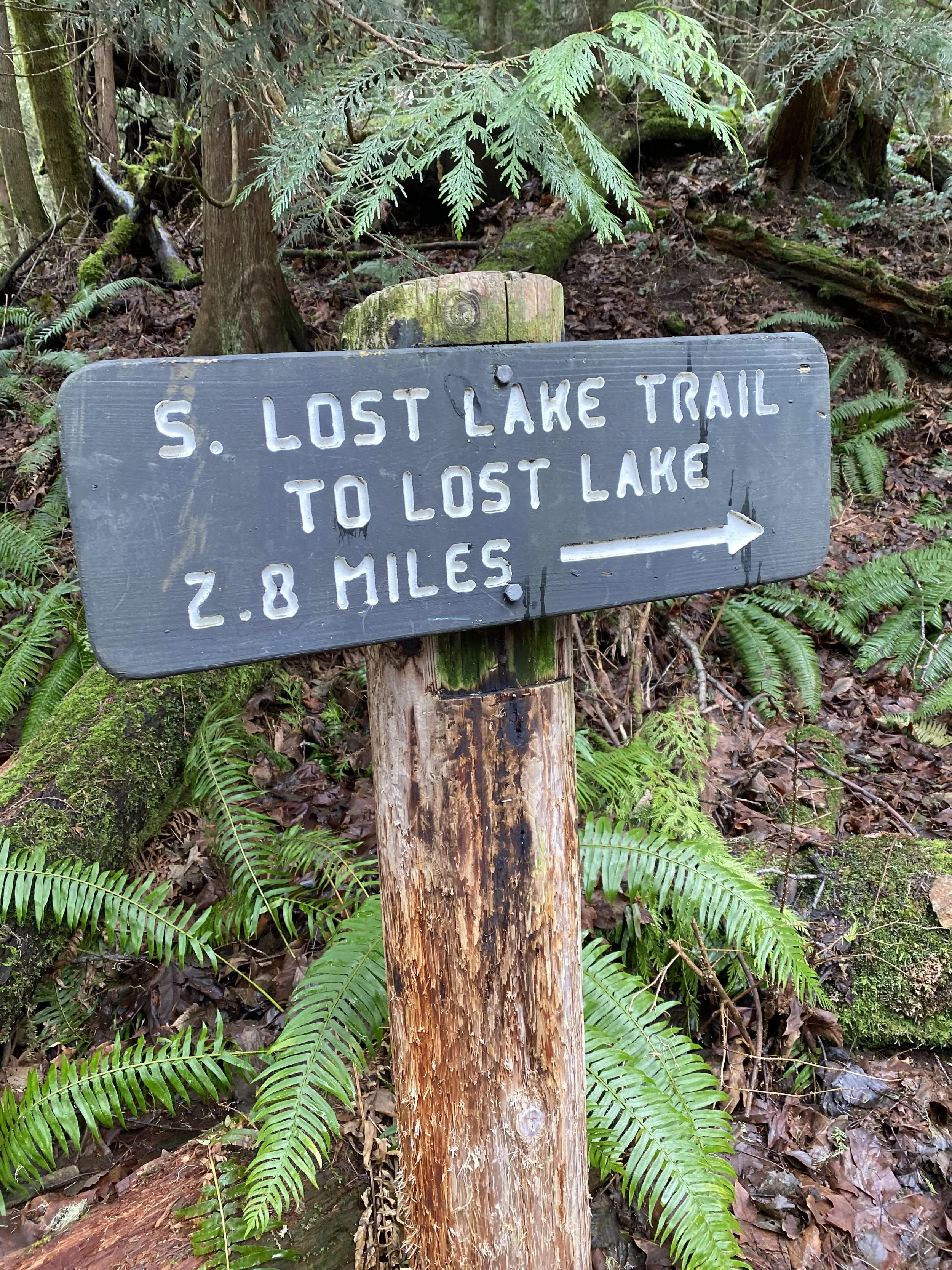
Finding your way to Lost Lake can be one of four routes that vary widely in terrain, views, and elevation profile. One of those is the South Lost Lake Trail, which in turn has two options for starting the hike. One starts close to the entrance to Larrabee State Park and the other starts from the Lost Lake (formerly Clayton Beach) parking area. We started the hike at 10 am, leaving directly from the parking area, following a service road. (This road was uphill all the way for 2.2 miles) We passed a cascading waterfall at 0.8 miles; (about 80 feet high) then we came across a spot where the road had lost about half its width due to a slide. We continued on for the remaining 1.2 miles before turning right at the sign for the beginning of the Lost Lake Trailhead.
The Lost Lake hiking trail follows the route of an old logging road in a southeasterly direction for 1.25 miles, steadily gaining elevation with occasional switchbacks. Along this segment, we ascend to a high point of 1650 feet with views of Samish Bay. Then we started to descend, and came to a sign at a junction, indicating that the route to Lost Lake is to the left. (Someone decided to add another .8 miles by going right, rather than left, to this awesome lookout over the bay and also a nasty clear-cut to the North) We then hiked back to the sign post and took the correct trail to the left towards the lake. We continued in a northerly direction 0.6 miles to a small waterfall, and then the junction with the Rock Trail, on our left. Continuing straight ahead; the lake is located approximately 0.6 miles beyond. As you pass red cedars and hemlocks, marvel at old growth, and stare at the rock walls to your left. We came across two crews from WTA removing some of the downed trees across the trail. After we reached the lake, at 1200 feet of elevation, we continued upward again briefly and reached the junction with the North Lost Lake Trail. We then went right and hiked along the East side of the lake to a large rock that offers clear views of the lake. We enjoyed a break here for lunch and a calm quiet time, except for a crow that was welcoming us to this special place. This is a great place to eat among the evergreen encircled waters.
After a brief lunch, we started our hike back to our original starting point at the parking lot. We hiked about 9.8 miles and must have done 1900 feet of elevation. (we made the hike longer than it needed to be) We arrived back at the parking lot at 4:30 pm. (a very long hike)
On our way home we stopped at Taylor’s Shellfish Farms along Chuckanut Drive and picked up some fresh mussels, shrimp and smoked oysters to enjoy at home.
Then we finished the hike by sitting down for a great fried oyster basket and burger dinner at the Conway Tavern. Oh, what a finish to a great day with friends exploring the outdoors.
Hikers included: Sylvia Shiroyama, Toni Williams, Kendra Wanzenried, Clarence Elstad, hike leader.
Submitted by Clarence Elstad
